Cross-country Lauterbach
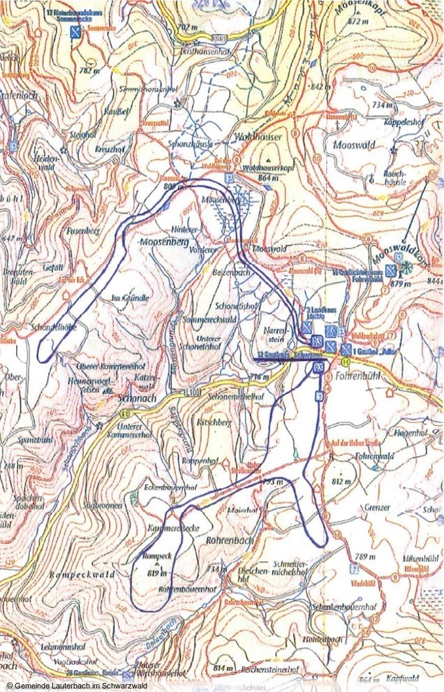
Two intermediate cross-country track rounds can be found at Lauterbach, offering approx. 16 km total length. Both trails offer a number of beautiful view points and are well-manageable. The first trail is approx. 7.5 km long and offers a diverse track with some ascents and forest passages. It starts just south of the country road No. 108, directly opposite the Landgasthof and runs at 780 m altitude in southern direction. After the initial part, which runs over a flat trail section, it starts ascending slightly and then leads across an open pasture. The trails forms a loop and leads back party via the same way it came. At the start and end point, a parking lot is available.
The second trail begins to the north of the same country road No. 108 and runs through a short forest area to vast open pasture. Some short descents bring you back into a loop to the original starting point. The round course is approx. 8 km long and at the start and end there are various place to grab a drink and unwind.

To enlarge please click onto the trail map


